Hartlepool Sports & Leisure
Hartlepool Transport
A Potted History Of Hartlepool
Hartlepool Trade & Industry
Hartlepool Health & Education
Hartlepool People
Hartlepool Places
Hartlepool at War
Hartlepool Ships & Shipping

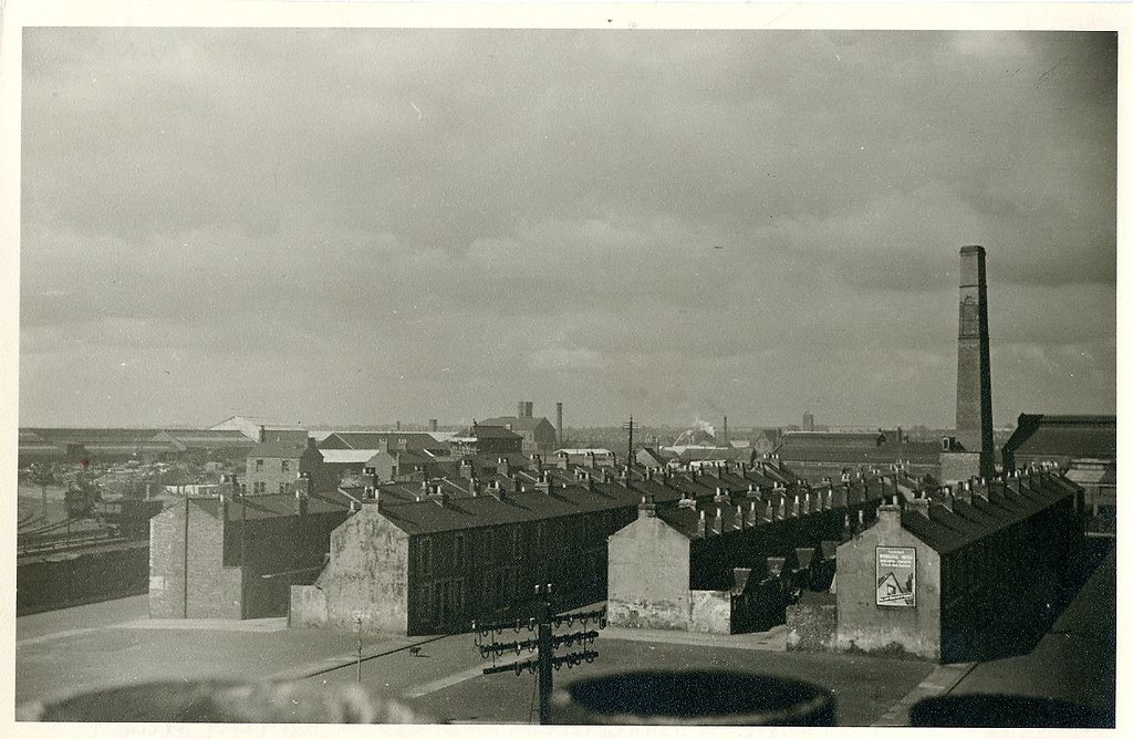
View of Burn Road area
What we know about this image :
Probably taken from a roof at the south end of Lynn Street, the houses on the far left would be those at the bottom of Burn Road and the other side of the road was a coal depot. The next street to the right would be Bedford Street and then Seamer Street on the far right. The council destructor chimney in Burn Road can clearly be seen and in the distance the tower of St Aidan's Church.
Part of the "Hartlepool Museum Service" collection
Location
Related items :
 Bedford Street (West Hartlepool)