Hartlepool Sports & Leisure
Hartlepool Transport
A Potted History Of Hartlepool
Hartlepool Trade & Industry
Hartlepool Health & Education
Hartlepool People
Hartlepool Places
Hartlepool at War
Hartlepool Ships & Shipping

Mainsforth Terrace looking north
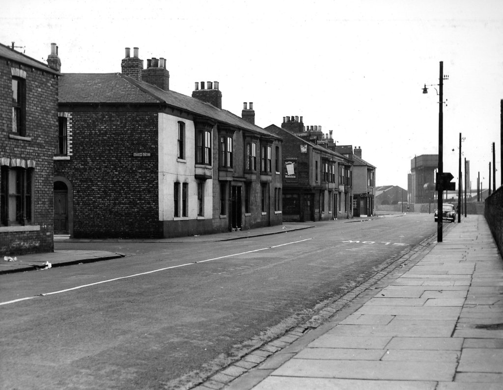
What we know about this image :
Taken in 1955, Nelson Street is on the left, then Outram Street, Alexandra Street and Havelock Street with the Lord Clyde on the corner of Havelock Street.
As can be seen, the railway is on the right and the mainenance depot.
The photo was from a photographic record of the Central Area of West Hartlepool prepared in 1955/6 at the request of the Town Planning and Redevelopment Committee 'in the hope that it will be of interest to future generations of West Hartlepool'
The record focuses on areas which were within the next ten years to be completely redeveloped following The Max Lock Plan. It was compiled by WL Taylor and photographs developed by Thomas Clarkson Chemist of Tower Street.
Date (of image) : 1955
Creator : West Hartlepool Council
Part of the "Hartlepool Public Houses" collection
Location
Related items :
 Havelock Street