Hartlepool Sports & Leisure
Hartlepool Transport
A Potted History Of Hartlepool
Hartlepool Trade & Industry
Hartlepool Health & Education
Hartlepool People
Hartlepool Places
Hartlepool at War
Hartlepool Ships & Shipping

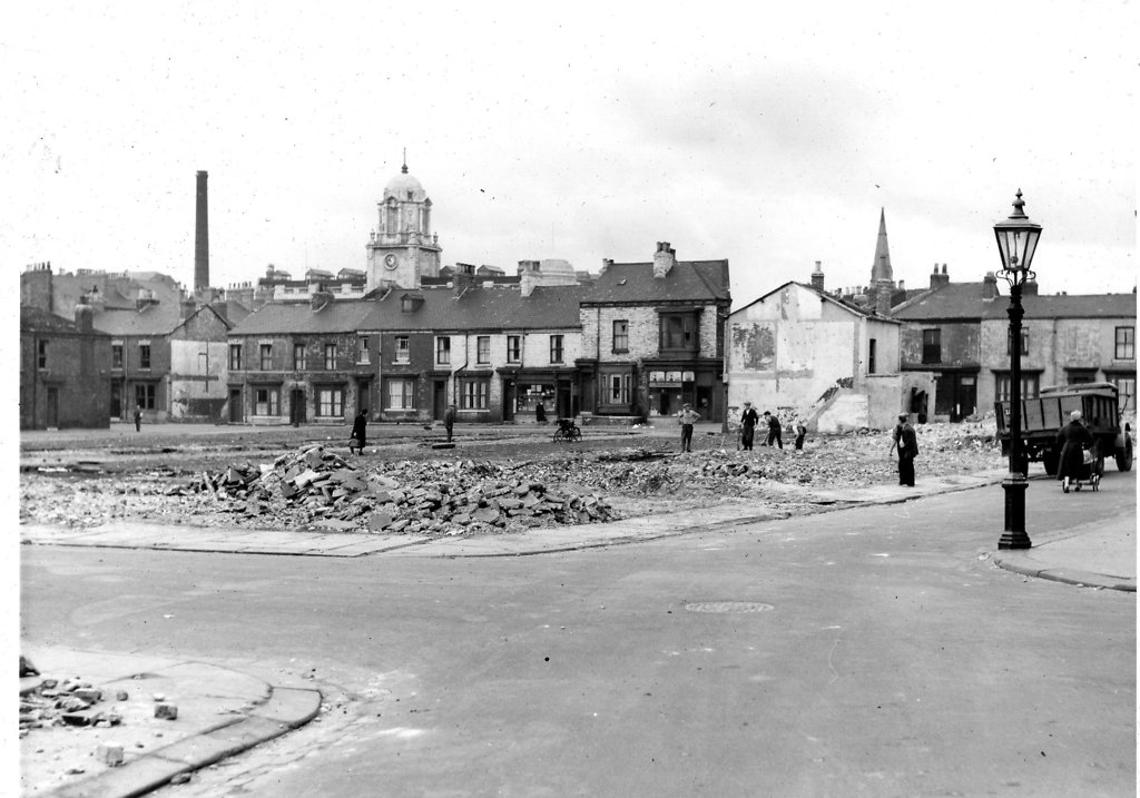
Brunswick Street
What we know about this image :
Taken from the junction of Raby Place and York Street in 1955. William Street, Brown Street and Harrison Street have just been cleared in the foreground. The Central Stores and Park Road Presbyterian Church are visible in the background.
The photo was from a photographic record of the Central Area of West Hartlepool prepared in 1955/6 at the request of the Town Planning and Redevelopment Committee 'in the hope that it will be of interest to future generations of West Hartlepool'
The record focuses on areas which were within the next ten years to be completely redeveloped following The Max Lock Plan. It was compiled by WL Taylor and photographs developed by Thomas Clarkson Chemist of Tower Street.
Date (of image) : 13/9/1955
Creator : West Hartlepool Council
Part of the "Library" collection
Location
Related items :
 Brunswick Street