Hartlepool Sports & Leisure
Hartlepool Transport
A Potted History Of Hartlepool
Hartlepool Trade & Industry
Hartlepool Health & Education
Hartlepool People
Hartlepool Places
Hartlepool at War
Hartlepool Ships & Shipping

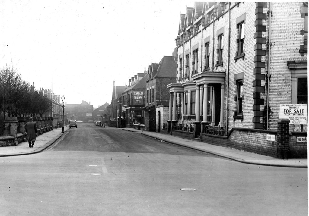
Avenue Road looking south from Victoria Road
What we know about this image :
On the right of the image is what had been Coverdale's School of Commerce but appears to be for sale and was to become Perry's TV and Radio for many years before being various wine bars. Victory Square is on the left and on the next corner on the right is Robinson's Garage. Villiers Street is in the distance.
The photo was from a photographic record of the Central Area of West Hartlepool prepared in 1955/6 at the request of the Town Planning and Redevelopment Committee 'in the hope that it will be of interest to future generations of West Hartlepool'
The record focuses on areas which were within the next ten years to be completely redeveloped following The Max Lock Plan. It was compiled by WL Taylor and photographs developed by Thomas Clarkson Chemist of Tower Street.
Date (of image) : 0/2/1956
Creator : West Hartlepool Council
Part of the "Library" collection
Location
Related items :
 Avenue Road