Created by West Hartlepool Council
Part of the Library collection
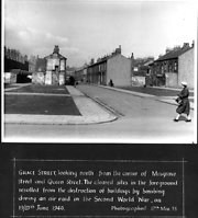
Looking north from Queen Street and Musgrave Street in 1955. The cleared sites areas a result of bombing 19th/20th June 1941. Alma Place is in the distance, and the building facing is in Exeter Street.
The photo was from a photographic record of the Central Area of West Hartlepool prepared in 1955/6 at the request of the Town Planning and Redevelopment Committee 'in the hope that it will be of interest to future generations of West Hartlepool'
The record focuses on areas which were within the next ten years to be completely redeveloped following The Max Lock Plan. It was compiled by WL Taylor and photographs developed by Thomas Clarkson Chemist of Tower Street.
More detail »


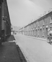
 Grace Street (1)